Oslo city map
You can find on this page the Oslo map to print and to download in PDF. The Oslo offline map presents the city center and the location in world map of Oslo in Norway.
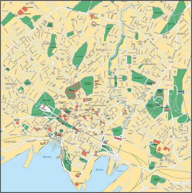
Oslo map
The Oslo map shows the detailed map and a large map of Oslo. This map of Oslo will allow you to orient yourself in Oslo in Norway. The Oslo map is downloadable in PDF, printable and free.
As of 1 January 2012, the population of the municipality of Oslo in excess of 610,000. The urban area extends beyond the boundaries of the municipality into the surrounding county of Akershus, (municipalities of Bærum, Asker, Røyken, Lørenskog, Skedsmo, Gjerdrum, Sørum, Oppegård) its agglomeration total 912,046 inhabitants. The metropolitan area of Oslo, also referred to as the Greater Oslo Region (Norwegian: Stor-Osloregionen), has a land area of 8,900 km2 (3,400 sq mi) with a population of 1,422,442 as of 1 April 2010 as you can see in Oslo map. The Inner Oslo Fjord Region, or the Capital Region made up by the 5 counties of Oslo, Akershus, Buskerud, Vestfold (west bank of the Oslo fjord) and Østfold (east bank) has a population of 1,908,231 people (as of October 2010).
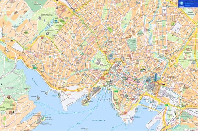
Oslo downtown map
The map of downtown Oslo shows the historical center of Oslo. This downtown map of Oslo will allow you to easily plan your visit in the center of Oslo in Norway. The Oslo downtown map is downloadable in PDF, printable and free.
The city centre or Oslo downtown is situated at the end of the Oslofjord, from which point the city sprawls out in three distinct “corridors” from its centre; inland north-eastwards and southwards along both sides of the fjord giving the city area more or less the shape of a reclining “Y” when seen from the north. Sentrum meaning city-center is located on the southeast side of the city near the inner Oslofjord. The district is dominated by high rises like Postgirobygget and The Plaza as you can see in Oslo downtown map. Oslo Central Station is located on the eastern side of the borough. Sentrum consists of Bjørvika which has a history as Oslo main harbor. The area is know being rebuilt with modern high rises consisting of the Barcode and also several student apartments, schools and museums. Sentrum is not a borough with an administration. It is partially administrated by St. Hanshaugen, and in part directly by the city council. The borough St. Hanshaugen takes care of health and social services.
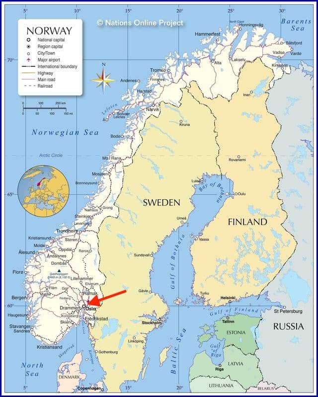
Oslo Norway map
Oslo on Norway map shows the location of the city of Oslo on the Norway map. This map of Oslo in Norway will allow you to easily plan your travel in Oslo in Norway. Oslo on map of Norway is downloadable in PDF, printable and free.
Oslo (English pronunciation: /ˈɒzloʊ/, oz-loh, Norwegian pronunciation: [²ʊʃlʊ] or [²ʊslʊ]) is the capital of and most populous city in Norway, and as such is the seat of Norway national government. Most government offices, including that of the Prime Minister, are gathered at Regjeringskvartalet, a cluster of buildings close to the national Parliament—the Storting as you can see in Oslo Norway map. Constituting both a municipality and a county of Norway, the city of Oslo is represented in the Storting by seventeen Members of Parliament. Six MPs are from the Labour Party; the Conservative Party and the Progress Party have three each; the Socialist Left Party and the Liberals have two each; and one is from the Christian Democrats.
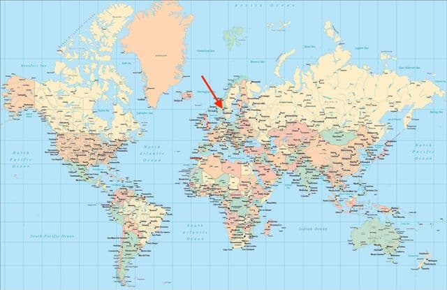
Oslo on world map
Oslo on world map shows the location of the city of Oslo in the world. Oslo on world map will allow you to easily know where is Oslo in the world. The Oslo in world map is downloadable in PDF, printable and free.
The city is home to many companies within the maritime sector, some of which are amongst the world largest shipping companies, shipbrokers and maritime insurance brokers. Oslo is a pilot city of the Council of Europe and the European Commission intercultural cities programme. Oslo is considered a global city and ranked “Beta World City” in studies performed by the Globalization and World Cities Study Group and Network in 2008 as you can see in Oslo on world map. It was ranked number one in terms of quality of life among European large cities in the European Cities of the Future 2012 report by fDi Magazine. For several years, Oslo has been listed as one of the most expensive cities in the world along with such other global cities, as Zurich, Geneva, Copenhagen, Paris, and Tokyo. In 2009, however, Oslo regained its status as the world most expensive city. A survey conducted by ECA International in 2011 placed Oslo 2nd after Tokyo.