Oslo bus system map
You can find on this page the Oslo buses map to print and to download in PDF. The Oslo bus system map and the Oslo trolley map present the network, stations and lines of the buses and trolley of Oslo in Norway.
Oslo bus map
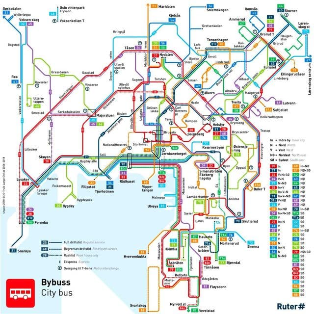
The Oslo bus map shows all the stations and lines of the Oslo bus system. This bus map of Oslo will allow you to easily plan your routes in the buses of Oslo in Norway. The Oslo bus system map is downloadable in PDF, printable and free.
The buses are single or articulated and their routes are connected to countryside buses, which are distinct from the Oslo public transportation system buses and use a different fare system as its mentioned in Oslo bus map. In 2012, buses accounted for the highest share in total journeys made through public transport, followed by the metro at 28 per cent, and trams at 16 per cent. In 2012, Ruter provided 37 million departures with a capacity of 7,336 million seat-km. The average seat occupancy including standing room places was 23 per cent. Route length covered 3,300 km with more than 3,000 stations and stops. The number of daily journeys made on the public transport system has grown from 244 million in 2008 to 295 million in 2012.