Oslo train map
You can find on this page the Oslo trains map to print and to download in PDF. The Oslo trains map presents the rail network and railway stations of the trains of Oslo in Norway.
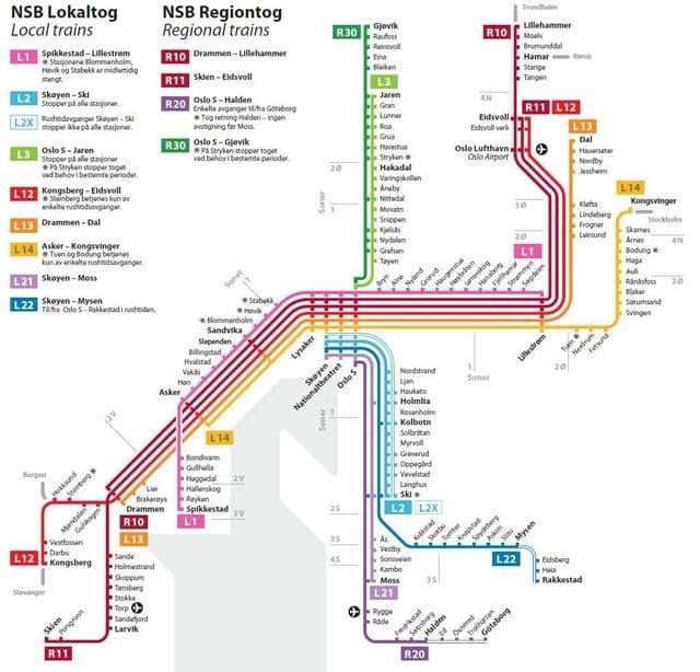
Oslo rail map
The Oslo rails map shows all the railway stations and lines of Oslo trains. This railway map of Oslo will allow you to easily plan your route with the trains of Oslo in Norway. The Oslo rails map is downloadable in PDF, printable and free.
By far the largest city in Norway, the capital of Oslo has a high concentration of the national rail infrastructure, notably in respect of servicing local travel needs amongst the metropolitan area population of over one million. Oslo curves around the head of Oslofjord, with rail routes mainly following the coastal strip or valleys leading away from the city centre as you can see in Oslo rail map. Given its relatively small size, Oslo offers a comprehensive public transport system, notably in respect of the multi-line metro. Most of the network uses a 750V dc via third rail, with overhead supply on parts of the Holmenkollbanen (Line 1, to the north) and Kolsåsbanen (Line 6, to the west) which have required two-system stock. The system is a mix of street running and reserved tracks. Compared to many urban systems with several modes, there are relatively few direct interchanges between trams, metro or heavy rail.