Oslo topographic map
You can find on this page the Oslo topographic map to print and to download in PDF. The Oslo elevation map present the topography, river and relief of Oslo in Norway.
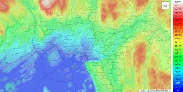
Oslo elevation map
The Oslo topographic map shows elevation, hills and landforms in Oslo. This elevation map of Oslo will allow you to know topography, river and relief of Oslo in Norway. The Oslo topographic map is downloadable in PDF, printable and free.
There are 40 islands within the city limits, the largest being Malmøya (0.56 km2/0.22 sq mi), and scores more around the Oslofjord. Oslo has 343 lakes, the largest being Maridalsvannet (3.91 km2/1.51 sq mi). This is also a main source of drinking water for large parts of Oslo. The highest elevation point is Kjrkeberget, at 629 metres (2,064 ft) as you can see in Oslo elevation map. Although the city population is small compared to most European capitals, it occupies an unusually large land area, of which two thirds are protected areas of forests, hills and lakes. Its boundaries encompass many parks and open areas, giving it an airy and green appearance.