Oslo tram map
You can find on this page the Oslo tram map to print and to download in PDF. The Oslo trams map presents the network, zones, stations and different lines of the tramway of Oslo in Norway.
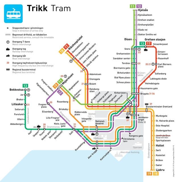
Oslo tramway map
The Oslo tram map shows all the stations and lines of the Oslo tramways. This tramway map of Oslo will allow you to easily plan your routes in the trams of Oslo in Norway. The Oslo tram map is downloadable in PDF, printable and free.
The Oslo Tramway (Norwegian: Oslotrikken) is a 131.4-kilometre (81.6 mi) tramway in Oslo, Norway which consists of six lines with 99 stops and has a daily ridership of 110,000 as you can see in Oslo tramway map. It is operated by Oslo Sporvognsdrift, a subsidiary of the municipal owned Kollektivtransportproduksjon who maintain the track and 72 tram vehicles on contracts with the public transport authority Ruter. The system operates on standard gauge and uses 750 overhead V DC. Depot, workshops and headquarters are at Grefsen (at the terminus of lines 13 and 17). There is also a depot at Holtet (along lines 18 and 19) that is home to the technical company InfraPartner, which maintains the track for the tram and metro systems in Oslo, and a small Office building for Oslo Sporveier.