Oslo neighborhood map
You can find on this page the Oslo neighborhood map to print and to download in PDF. The Oslo districts map presents quarters, region, suburbs and surrounding area of Oslo in Norway.
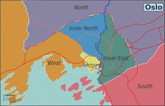
Oslo neighborhoods map
The Oslo neighborhoods map shows region and suburbs of Oslo areas. This neighborhood map of Oslo will allow you to discover quarters and surrounding area of Oslo in Norway. The Oslo quarters map is downloadable in PDF, printable and free.
Central Oslo is the heart of the city – the most crowded and traffic-congested, but also the most convenient place to stay. Those on the most rushed of schedules – the average visitor spends only 2 days in Oslo – will book accommodations in the center. It is not a real neighborhood, but it is the core of the city, as Piccadilly Circus is to London. Most Oslo hotels and restaurants are here, as are almost 50 museums and galleries – enough to fill many a rainy day. The best of the lot include Akershus Castle, the Historical Museum, and the National Gallery as you can see in Oslo neighborhoods map. The Old Town (or Gamlebyen) lies south of the Parliament Building (the Stortinget) and Karl Johans Gate. This section contains some of the city old-fashioned restaurants, along with the Norwegian Resistance Museum and the Old Town Hall. A stay here is the same as staying in central Oslo . The only difference is that the streets of the Old Town have more old-fashioned Norwegian flavor than the more modern parts of central Oslo.
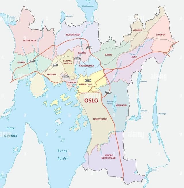
Oslo districts map
The Oslo districts map shows all quarters and suburbs of Oslo. This district map of Oslo will allow you to discover areas and the region of Oslo in Norway. The Oslo districts map is downloadable in PDF, printable and free.
In addition to the city centre, Oslo has 15 administrative districts, or boroughs. Known in Norwegian as a bydel (plural: bydeler), each district is overseen by a district committee, elected every four years by city residents at the same time as the regular city council elections. The current 15 districts were created when a local government reform in 2004 reduced the number from 25 as you can see in Oslo districts map. The compact city centre of Oslo is not a separate district, as the city council prefers to take on the management of land use itself. However, there are some residents of the central district, so responsibility for these falls to St Hanshaugen. Previously, Bygdøy-Frogner and Gamle Oslo had some responsibility. The area defined as sentrum includes Vika, Kvadraturen, the streets north of Karl Johans gate, the western half of Bjørvika, and Vaterland.